I had the alarm set this morning for 5:30, but when it went off, I decided to change my plans for today. :) That meant I shut it off and went back to sleep for another hour. I believe that’s the first time I’ve ever done that! I usually make a plan and carry it through. I was going to head into Yellowstone early since the construction delays were eliminated for this big holiday weekend. Oh well, since I packed a lunch last night, I decided to leave a little later and visit the Madison River Canyon Earthquake Area instead. I’m glad I did as it was a wonderful day to for that particular trip.

As I headed up Rt. 87, I stopped to get a shot of Henry’s Lake. The park I’m in is just to the left of this photo under Sawtell peak which is the mountain on the left.
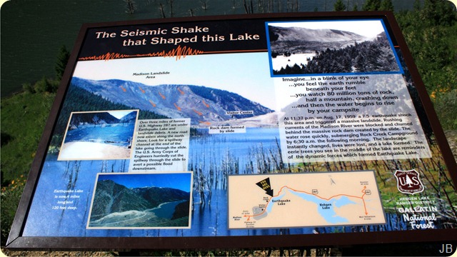
This sign explains about the earthquake in 1959 that changed the landscape in just a few moments. (click to enlarge and be able to read it)
First stop was the Visitor’s Center. These are the views looking West and East from the VC. I was just in time for the interpretive talk about the earthquake. The young lady that gave the talk was excellent, and I’d recommend listening to this talk for a very interesting understanding of what happened on the night of August 17, 1959. Last year was the 50th anniversary of the earthquakes, and the speaker had spoken to several of the survivors, so she was able to relate their experiences of that night. 28 people died that night, and the Rock Creek Forest Service Campground now lies 100’ under water. The earthquake caused this massive flooding.

Half of a mountain collapsed and blocked the flow of the Madison River and formed what is now called Earthquake Lake. You can see the slide area in the left center portion of this picture. The numerous stands of dead trees used to be along the shore of the Madison River.
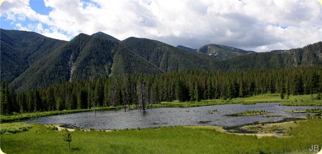
I stopped at one of the wetlands along the road. I was hoping to see a Barrow’s Goldeneye that nest in this area.
But all I could find were a bunch of ring-necked ducks.

One of the stops along the Auto Tour Route was the Building Destruction pull off. This is one of the resorts that ended up sliding off the mountain into Hebgen Lake during the earthquake. It’s remains are still visible after 50 years.
Luckily, there were lots of wildflowers to look at on the trail back up from the submerged resort. I swear, the trip back up was longer than the trip down. :)

What a view there was as I approached the parking lot where I would have my picnic lunch! There were abundant wildflowers, Hebgen Lake, and mountains. One of the advantages of visiting historic Forest Service sites (and National Wildlife Refuges) is that I can take Emma on the trails with me. That isn’t the case in most National Parks and Monuments. :(
As I exited the Building Destruction area, I noticed two young bucks on the hillside. I’m not sure how big those racks will be, but they’re well on their way.

Several miles down the road, I turned onto Red Canyon Road. It led up into the Gallatin National Forest and the location of the fault scarp involved in the earthquake. (I'm really not sure what fault scarp is, or if I'd recognize it if I ran into it!:))
The roadside was covered with a carpet of these white flowers. They were quite small, but profuse. I was hoping to see a bear or a moose on this meandering hilly gravel road into the mountains, but it was not to be.
On the way out of Red Canyon Road, I just couldn’t pass up these fences. The fences in Idaho and Montana are so much more picturesque than chain link or barbed wire. :)
It took Emma andme about six hours and 80 miles to do this scenic loop tour today. Once we arrived back at home, the skies became overcast, and an off and on drizzle began. I’m glad I changed my mind this morning. It was a wonderful day in the neighborhood. :)
Thanks for stopping by….talk to you late, Judy

 Emma and I went on a drive of some of the back roads again this evening for me to get some shots to experiment with.


 Flowers can’t run or fly away from you, so I thought I’d start there. :)

 A slightly different view of Henry’s Lake. I took a national forest dirt road up the hillside across from the campground.
 Then we took a drive up to the continental divide. It’s open range around here, so bovine encounters are quite common in the summer.


 Posts


